Articles
Google Maps now shows Covid intensity to warn you
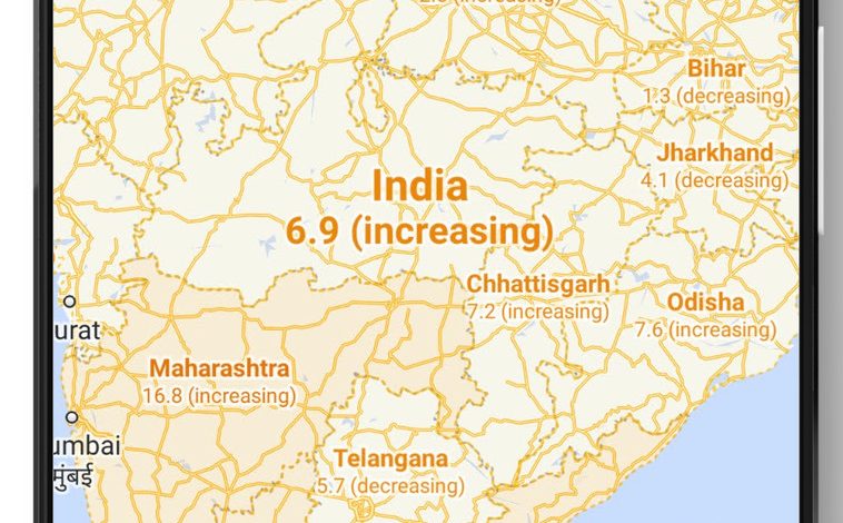
Google Maps will now allow you to see intensity of Covid with additional features like COVID-19 intensity in transit, COVID checkpoints etc. This can be enabled by turning on ‘COVID-19 info’ from layers selection (layers button on top right hand corner).

Once you select or enable COVID info in your maps, you will see seven day average of new cases per 100,000 perope for the area in maps. You will also see label that shows whether there is increase or decrease of covid cases. There will also be color coding that helps to distinguish between areas as per covid cases.